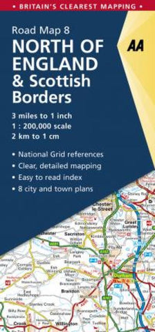
England North of & Scottish Borders 8
Britains clearest mapping from the experts at the AA, in a handy foldable road map covering North England and Scottish Borders. Fully updated, the map combines clear design and an easy-to-read scale of 3 miles to 1 inch, with more road detail to ensure you never lose your way while navigating Britains roads. The map includes information on toll points, service areas, road numbers, motorways, dual carriageways and wide and narrow local roads. National parks and places of interest are also highlighted.
- Product Number: AAP_GB_8_22
- Reference Product Number: - None -
- ISBN: 9780749582876
- Date of Publication: 6/1/2022
- Folded Size: 9.84 inches high by 4.72 inches wide
- Unfolded (flat) Size: 45.67 inches high by 35.83 inches wide
- Map format: Folded
- Map type: Trade Maps - Road
- Geographical region: United Kingdom
- Geographical subregion: England,Scotland