
Height of the Rockies Provincial Park Adventure Topographic Map
Height of the Rockies Provincial Park Map BC
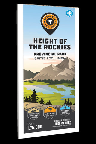
Covering Height of the Rockies Provincial Park in BC, this topographic recreation map highlights all the campgrounds, forest service access roads, trails for hiking, horseback riding, mountain biking, cross-country skiing and snowshoeing, backcountry huts and cabins, fishing rivers and lakes, surrounding areas and more! Shown at 1:80,000 scale, this map features our industry-leading topographic contours and relief shading. Included on the map are Connor Lakes, Elk Lakes, Forsyth Creek, Great Divide Trail, Joffre Creek Trail, Kananaskis Lakes, Limestone Lakes, Maiyuk Creek, Mount King George, Palliser River, Queen Mary Lake, Ralph Lake, The Royal Group Mountains, White River and more!
The printed version of the map is displayed at 1:80,000 scale on 61 x 94 cm (24 x 37 in) paper on a durable waterproof synthetic material. The Wall Maps have been customized to display nicely and fit into common picture frame sizes so you can hang o
- Product Number: BRM_ADV_H_ROCK_23
- Reference Product Number: - None -
- ISBN: - None -
- Date of Publication: 12/1/2023
- Folded Size: 9 inches high by 4 inches wide
- Unfolded (flat) Size: 37 inches high by 24 inches wide
- Map format: Folded
- Map type: Trade Maps - Outdoor Recreation Maps
- Geographical region: Canada
- Geographical subregion: British Columbia


