
Atlantic Canada Road Map
MapArt folded maps have been the trusted standard for years, offering unbeatable accuracy and reliability at a great price. Detailed indices make for quick and easy location of destinations. It’s a must-have for anyone travelling in Atlantic Canada.
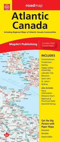
The Atlantic Canada folded map includes provincial maps of Newfoundland (1:1,400,000), Atlantic Canada (New Brunswick, Nova Scotia, Prince Edward Island, Gaspé Peninsula) at 1:800,000, Eastern Canada (1:4,500,000). Regional maps included are Charlottetown (1:90,000), Fredericton (1:100,000), Halifax (1:250,000), Happy Valley (1:52,000), Goose Bay (1:52,000), Labrador City (1:40,000), Moncton (1:100,000), Saint John (1:140,000), St. John’s (1:55,000), Sydney (1:100,000) as well as ferry Information and a distance chart.
Provincial map features include multi-lane highways, toll highways, Trans-Canada highway, highways, secondary highways, local roads, unpaved roads, unimproved roads, ferries, accumulated distances, airports, border
- Product Number: CCC_ATL_CAN_23N
- Reference Product Number: - None -
- ISBN: 9781554862375
- Date of Publication: 1/1/2023
- Folded Size: 9.45 inches high by 3.94 inches wide
- Unfolded (flat) Size: 39.37 inches high by 27.17 inches wide
- Map format: Folded
- Map type: Trade Maps - Road
- Geographical region: Canada
- Geographical subregion: New Brunswick,Newfoundland,Nova Scotia,Prince Edward Island,Quebec


