
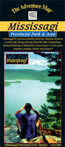
Mississagi Provincial Park & Area Hiking Map
Our guide to this superb hiking and paddling area just north of Elliot Lake, Ontario, includes not only Mississagi P.P., but also the Rawhide Lake Conservation Area, and portions of Matinenda and Blind River P.P.s. That whole area is available for paddling and hiking opportunities with over 50 kilometres of rugged hiking trails with really top-notch lookouts (see the map cover), and over 150 kilometres of excellent wilderness paddling routes.
This waterproof, 1:50,000 scale, completely original (like all the others) topographic map has unprecedented detail, and includes all hiking trails, portages, access points and backcountry campsites, plus many other features.
The map measures 21x24, has a contour interval of 15 metres, and includes text and photos about natural and human history, trail and canoe route descriptions, safety tips, contact info, great colour photographs - in short just about everything youd want to help you plan and enjoy your trip.
Below is a s
- Product Number: CHR_MISS_20
- Reference Product Number: 2301197M
- ISBN: 9780929140858
- Date of Publication: 6/1/2020
- Folded Size: 9 inches high by 4 inches wide
- Unfolded (flat) Size: 24 inches high by 21 inches wide
- Map format: Folded
- Map type: Trade Maps - Hiking
- Geographical region: Canada
- Geographical subregion: Ontario


