
Columbia Icefield Map (6th edition)
Waterproof and tear-resistant hiking and recreation map for the Columbia Icefield region of the Canadian Rockies.
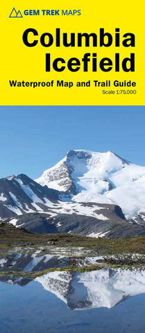
Updated with the latest satellite imagery of the icefield extent, Gem Treks Columbia Icefield Map is designed for visitors looking to explore North America s largest icefield south of Alaska. Located beside the Icefields Parkway in Jasper National Park, the icefield is both spectacular and accessible. Whether you are touring along the parkway and taking an Ice Explorer out onto the Athabasca Glacier or heading off to explore the surrounding wilderness on foot, youll find the waterproof and tear-resistant Columbia Icefield an invaluable tool for making the most of your visit.
The Columbia Icefield Map features detailed cartography, accurate hiking trails with distances, and details such as glacier flow direction and drainage routes. Campgrounds and highway viewpoints are also marked.
In addition to the map, this product is a user-friendly guide to the
- Product Number: GEM_COLUMBIA_20
- Reference Product Number: - None -
- ISBN: 9781895526967
- Date of Publication: 1/1/2020
- Folded Size: 10.24 inches high by 4.72 inches wide
- Unfolded (flat) Size: 19.29 inches high by 17.32 inches wide
- Map format: Folded
- Map type: Trade Maps - Park
- Geographical region: Canada
- Geographical subregion: Alberta


