
Saint Gervais les Bains : Massif du Mont Blanc (3531 ET)
Mont Blanc Massif (St-Gervais - Les-Bains - Massif du Mont Blanc, France) 1:25,000 Hiking Map IGN # 3531ET.
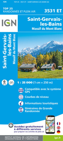
This IGNs excellent map No. 3531 ET, St-Gervais - Les-Bains - Massif du Mont Blanc, is centered on the peak of Mont Blanc and covers the main part of the massif from Aiguille du Moine to Col du Petit St-Bernard. The map shows the southern section of the Tour du Mont Blanc (TMB) between Chamonix and Courmayeur in Italy and is overprinted with a UTM grid for GPS users. The terrain is shown at extremely detailed scale of 1:25,000 (2.53 in = 1 mile), contour interval is 10 m. An overprint highlights local footpaths, long-distance GR routes and ski routes. Other tourist information indicated by symbols includes campsites, equestrian or canoeing centers, huts, mountain refuges, notable sites, etc. Map legend is in French and English. The map covers an area of approximately 28 x 21 km / 17 x 13 miles.
- Product Number: IGN25_3531ET_23
- Reference Product Number: - None -
- ISBN: 9782758554165
- Date of Publication: 6/1/2023
- Folded Size: 9.45 inches high by 4.33 inches wide
- Unfolded (flat) Size: 38.19 inches high by 53.94 inches wide
- Map format: Folded
- Map type: Topographic - General Topographic
- Geographical region: France


