
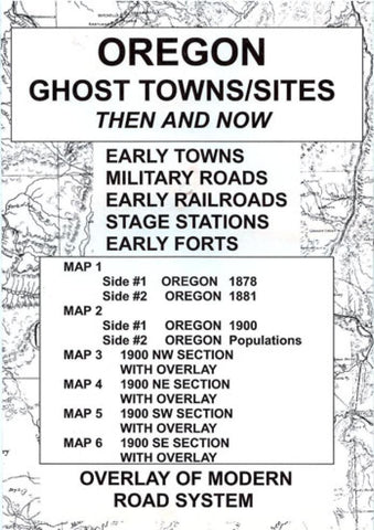
Oregon : ghost towns/sites : then and now
Fascinating series of 6 maps showing historic ghost towns around the state of Oregon. Map 1 shows Oregon in 1878, and in 1881. Map 2 shows Oregon in 1900, and Oregon town populations in 1900, 1980, and 1999. Maps 3, 4, 5, and 6 show Oregons northwest, northeast, southwest, and southest respectively, in the year 1900 with a red overlap on each showing Oregon today.
- Product Number: NWD_OR_GHOST_21
- Reference Product Number: - None -
- ISBN: 9780965755856
- Date of Publication: 6/1/2021
- Folded Size: 9.45 inches high by 6.3 inches wide
- Unfolded (flat) Size: 22.05 inches high by 16.93 inches wide
- Map format: Folded
- Map type: Trade Maps - Specialty
- Geographical region: United States
- Geographical subregion: Oregon


