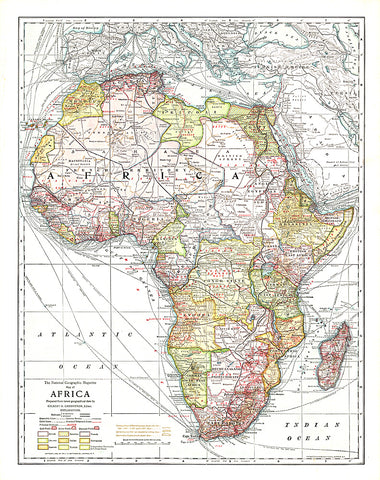
1909 Africa Map
This historic map of Africa takes you back to 1909, a time when the Dark Continent was barely known in the outside world. A time when the only way to get to far off places like Abyssinia, the Congo State, and Bechuanaland Protectorate was to take a long sea voyage, then travel many miles by rail. National Geographic was among the first to bring this amazing land to the world, and this incredible map provides a time capsule into these times. Artistic cartography and painstaking detail make this a map for any collector.
- Product Number: PODHNG_AFR_09
- Reference Product Number: 2321399M
- ISBN: - None -
- Date of Publication: 6/1/1909
- Unfolded (flat) Size: 21.5 inches high by 17 inches wide
- Map format: Wall
- Map type: Trade Maps - Political