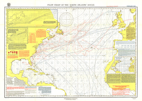
1903 Pilot Chart of the North Atlantic Ocean Map
The Pilot Chart of the North Atlantic Ocean is a fascinating historical piece which appeared in National Geographic Magazine in February 1903, a time when all travel and trade across the Atlantic was done by boat. It contains recommended routes for steamships, branch hydrographic offices, and a wealth of information about weather patterns over the ocean including storm and gale signals, cyclonic storm tracks, fog reports and more. A truly unique map for collectors.
- Product Number: PODHNG_ATL_O_PC_03
- Reference Product Number: 2321592M
- ISBN: - None -
- Date of Publication: 6/1/1903
- Unfolded (flat) Size: 24 inches high by 34 inches wide
- Map format: Wall
- Map type: Trade Maps - Wall Art