
~ Adrian MI topo map, 1:100000 scale, 30 X 60 Minute, Historical, 1985, updated 1985
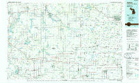
Adrian, Michigan, USGS topographic map dated 1985.
Includes geographic coordinates (latitude and longitude). This topographic map is suitable for hiking, camping, and exploring, or framing it as a wall map.
Printed on-demand using high resolution imagery, on heavy weight and acid free paper, or alternatively on a variety of synthetic materials.
Topos available on paper, Waterproof, Poly, or Tyvek. Usually shipping rolled, unless combined with other folded maps in one order.
- Product Number: USGS-5443520
- Free digital map download (high-resolution, GeoPDF): Adrian, Michigan (file size: 21 MB)
- Map Size: please refer to the dimensions of the GeoPDF map above
- Weight (paper map): ca. 55 grams
- Map Type: POD USGS Topographic Map
- Map Series: HTMC
- Map Verison: Historical
- Cell ID: 67015
- Scan ID: 278619
- Imprint Year: 1985
- Woodland Tint: Yes
- Aerial Photo Year: 1983
- Edit Year: 1985
- Datum: NAD27
- Map Projection: Universal Transverse Mercator
- Planimetric: Yes
- Map published by United States Geological Survey
- Map Language: English
- Scanner Resolution: 600 dpi
- Map Cell Name: Adrian
- Grid size: 30 X 60 Minute
- Date on map: 1985
- Map Scale: 1:100000
- Geographical region: Michigan, United States
Neighboring Maps:
All neighboring USGS topo maps are available for sale online at a variety of scales.
Spatial coverage:
Topo map Adrian, Michigan, covers the geographical area associated the following places:
- Berlien - Austin - California - Stringtown - Addison - Addison Junction - Fairview Estates Mobile Home Park - Ottokee - West View Subdivision - Columbia - Kings Court Mobile Park - Montgomery - Robin Hood Mobile Court - Clayton - Seward - Forest Park - Ray - Prattville - Baldwin (historical) - Birdsall - Algansee - Tedrow - Reading - Geneva - Lake Seneca - Deer Lick (historical) - Rome Center - Tiffin Meadows - Jasper - Primrose - Cooney - Jonesville - Timber Creek - Hillsdale - Ainger - Billingstown - Camden - Dover Glen - Archbold - Oakshade - Pioneer Mobile Home Park - Ottokee Station - Hillside Acres Mobile Home Park - Canada Shores - Leffingwell Estates Mobile Home Park - Adrian - Powers - Cambria - Hamilton - West Buffalo (historical) - Courtney Corner - Denson - Cadmus - Zone - Caster Subdivision - Northwest - Hamer - Edon Home Court - Pittsford - Greyhound - Rollin - Elmira - Russels Point - Montpelier - Plattston (historical) - Fountain Park - Camelot South - West Delta - North Adams - Otsego Center - Angola - Fayette - Southgate Mobile Park - Ellis - Hillcrest - Kunkle - Lickly Corners - Jim Town - Haller (historical) - Wauseon - Locust Corners - Lyons - Maplecrest - Steamburg - Parkview Mobile Home Court - Fountain Park - Nettle Lake - Inlet - Pioneer - Bankers - Sterling Estates Mobile Home Park - Waldron - Pearl Beach - Fremont - Grimms Subdivision - Frontier - Jefferson Estates - Weston - Terrace Aires - Metz
- Map Area ID: AREA4241.5-85-84
- Northwest corner Lat/Long code: USGSNW42-85
- Northeast corner Lat/Long code: USGSNE42-84
- Southwest corner Lat/Long code: USGSSW41.5-85
- Southeast corner Lat/Long code: USGSSE41.5-84
- Northern map edge Latitude: 42
- Southern map edge Latitude: 41.5
- Western map edge Longitude: -85
- Eastern map edge Longitude: -84


