
082E16 Edgewood Canada topo map, 1:50,000 scale
082E16 Edgewood NRCAN topographic map.
Includes UTM and GPS geographic coordinates (latitude and longitude). This 50k scale map is suitable for hiking, camping, and exploring, or you could frame it as a wall map.
Printed on-demand using high resolution, on heavy weight and acid free paper, or as an upgrade on a variety of synthetic materials.
Topos available on paper, Waterproof, Poly, or Tyvek. Usually shipping rolled, unless combined with other folded maps in one order.
- Product Number: NRCAN-082E16
- Parent Topo: TOPO-082E
- Map ID also known as: 082E16, 82E16
- Unfolded Size: Approximately 26" high by 36" wide
- Weight (paper map): ca. 55 grams
- Map Type: POD NRCAN Topographic Map
- Map Scale: 1:50,000
- Geographical region: British Columbia, Canada
Neighboring Maps:
All neighboring Canadian topo maps are available for sale online at 1:50,000 scale.
Purchase the smaller scale map covering this area: Topo-082E
Spatial coverage:
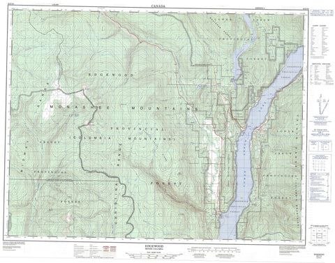
Topo map sheet 082E16 Edgewood covers the following places:
- Grassy Point - The Needles - Lindsay Lake - Lower Arrow Lake - Snowshoe Lake - Whatshan Lake - Whatshan Lakes - York Lake - Christina Range - Columbia Mountains - Galloping Mountain - Glen Paige Ridge - Goat Mountain - Gunwad Mountain - Midway Range - Monashee Mountains - Mount Carleton Brown - Mount Scaia - Mount York - Mount Young - Selkirk Mountains - Valhalla Mountains - Valhalla Range - Valhalla Ranges - Valkyr Mountains - Valkyr Range - Whatshan Range - Regional District of Kootenay-Boundary - Arrow Lakes Park - Granby Park - Inonoaklin Park - Andres Creek - Banting Creek - Barnes Creek - Bates Creek - Bench Creek - Brydges Creek - Burrell Creek - Christie Creek - Christy Creek - Columbia River - Cortiana Creek - Delta Creek - Eagle Creek - Fauquier Creek - Fern Creek - Fleuve Columbia - Funk Creek - Galloping Creek - Granby River - Heart Creek - Heaton Creek - Inonoaklin Creek - Johnston Creek - Lindsay Creek - Lovesay Creek - McDermot Creek - McGill Creek - McIntosh Creek - McLean Creek - Nesbitt Creek - Pin Creek - Rampalo Creek - Robinson Creek - Sally Creek - Stoney Creek - Taite Creek - Teepee Creek - Valley Creek - Whatshan River - Winnifred Creek - Worthington Creek - Yellow Creek - York Creek - Applegrove - Edgewood - Fauquier - Forslund - Killarney - Needles - Fire Valley - Glen Paige Valley


