
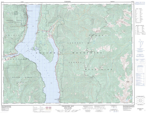
082F10 Crawford Bay Canada topo map, 1:50,000 scale
082F10 Crawford Bay NRCAN topographic map.
Includes UTM and GPS geographic coordinates (latitude and longitude). This 50k scale map is suitable for hiking, camping, and exploring, or you could frame it as a wall map.
Printed on-demand using high resolution, on heavy weight and acid free paper, or as an upgrade on a variety of synthetic materials.
Topos available on paper, Waterproof, Poly, or Tyvek. Usually shipping rolled, unless combined with other folded maps in one order.
- Product Number: NRCAN-082F10
- Parent Topo: TOPO-082F
- Map ID also known as: 082F10, 82F10
- Unfolded Size: Approximately 26" high by 36" wide
- Weight (paper map): ca. 55 grams
- Map Type: POD NRCAN Topographic Map
- Map Scale: 1:50,000
- Geographical region: British Columbia, Canada
Neighboring Maps:
All neighboring Canadian topo maps are available for sale online at 1:50,000 scale.
Purchase the smaller scale map covering this area: Topo-082F
Spatial coverage:
Topo map sheet 082F10 Crawford Bay covers the following places:
- Crawford Bay - Kootenay Bay - Pilot Bay - Queens Bay - Sawmill Cove - Burgess Point - Cape Horn - McEwen Point - Mile Point - Pilot Peninsula - Pilot Point - Pilot Point - Sawmill Point - Sun Point - Ainsworth Cave - Cody Caves - Fraser Narrows - Crystal Lake - Fraser Lake - Kootenay Lake - Krao Lake - Loon Lake - McGregor Lake - Walkers Landing - Balfour Knob - Browns Peak - Burdett Peak - Columbia Mountains - Hazel May - Hooker Mountain - Hungry Peak - Kokanee Range - Mount Aylmer - Mount Crawford - Mount Hartridge - Mount Hooker - Mount Irvine - Mount Rice - Nelson Range - Old Tom Mountain - Purcell Mountains - Selkirk Mountains - Seven Sisters - Snowcrest Mountain - Sphinx Mountain - Regional District of East Kootenay - Cody Caves Park - Kootenay Lake Park - Kootenay Lake Recreation Area - Lockhart Beach Park - Pilot Bay Park - Aylmer Creek - Baker Creek - Baribeau Creek - Beaver Creek - Birkbeck Creek - Bridalveil Creek - Burden Creek - Cabbage Creek - Canyon Creek - Cedar Creek - Coffee Creek - Cornbeef Creek - Crawford Creek - Croasdaile Creek - Flatrock Creek - Gray Creek - Grays Creek - Haatsa Creek - Hadden Creek - Haddon Creek - Heather Creek - Hooker Creek - Houghton Creek - Hungry Creek - Irvine Creek - Johnson Creek - Kootenay River - Krao Creek - La France Creek - Laird Creek - Langford Creek - Leake Creek - Lindsay Creek - Lockhart Creek - Madden Creek - McFarlane Creek - Midge Creek - Mosquito Creek - Munn Creek - Narrows Creek - Orebin Creek - Preacher Creek - Procter Creek - Queens Creek - Ross Creek - Rucks Creek - Sawyer Creek - Sherraden Creek - Skunk Creek - Spring Creek - Squaw Creek - Washout Creek - Weasel Creek - Willow Creek - Wilmot Creek - Wilson Creek - Yasodhara Creek - Ainsworth Hot Springs - Sherwin Hot Spring - Sherwin Hot Springs - Ainsworth - Ainsworth Hot Springs - Balfour - Blake - Crawford Bay - Deanshaven - Fraser - Gray Creek - Kootenay Bay - Nasookin - Pilot Bay - Procter - Queens Bay - Walkers - Cogle Pass - Hooker Pass - Sawyer Pass


