
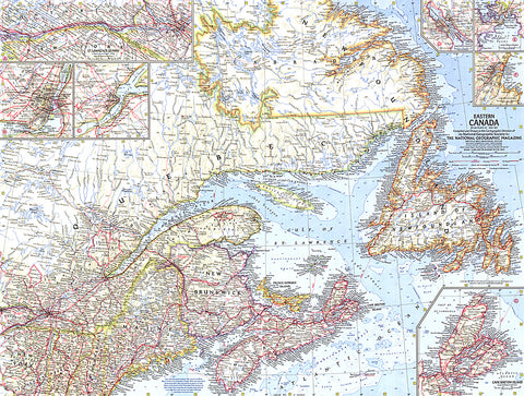
1967 Eastern Canada Map
Explore the multitude of harbors, bays, inlets, and rivers to be found in Newfoundland, Labrador, Quebec, and the Maritime provinces with this compelling map of Eastern Canada. Includes wonderful detail of the region with inset maps of the provincial capitals, as well as maps of Cape Breton Island and the St. Lawrence Seaway. Published in May 1967, makes a fine companion to the maps of Central Canada (1963) and Western Canada (1966).
- Product Number: PODHNG_CAN_E_67
- Reference Product Number: 2321553M
- ISBN: - None -
- Date of Publication: 6/1/1967
- Unfolded (flat) Size: 18.75 inches high by 25 inches wide
- Map format: Wall
- Map type: Trade Maps - Political
- Geographical region: Canada


