
1987 Great Lakes Map Side 1
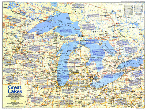
Comprised of Lake Superior, Lake Michigan, Lake Huron, Lake Erie, and Lake Ontario, the Great Lakes are the largest group of freshwater lakes on earth. This map of the Great Lakes region, which abuts both Canada and the United States, contains a vast amount of historical information, as well as tourist attractions. Published in July 1987 as part of the Making of America series.
- Product Number: PODHNG_US_CAN_GRE_LAK_87_1
- Reference Product Number: 2321266M
- ISBN: - None -
- Date of Publication: 6/1/1987
- Unfolded (flat) Size: 20.25 inches high by 27 inches wide
- Map format: Wall
- Map type: Trade Maps - Political
- Geographical region: Canada,United States
- Geographical subregion: Illinois,Indiana,Michigan,Minnesota,New York,Ohio,Ontario,Quebec,Wisconsin


