
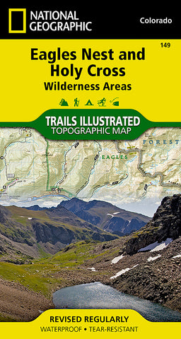


Holy Cross and Eagles Nest Wilderness, Map 149 by National Geographic Maps
• Waterproof • Tear-Resistant • Topographic Map
National Geographics Trails Illustrated map of Holy Cross and Eagles Nest Wilderness is a two-sided, waterproof map designed to meet the needs of outdoor enthusiasts with durability and detail. This map was created in conjunction with local land management agencies and is loaded with valuable recreation information.
The front side of Eagles Nest and Holy Cross Wilderness map details the north side of the area, including Arapaho National Forest, White River National Forest, Eagles Nest Wilderness, Ptarmigan Peak Wilderness and Byers Peak Wilderness. The insets show survival tips, wilderness conduct, and contact information to local National Forests. The reverse side of the map details the south side of the area, including White River National Forest, San Isabel National Forest, Pike National Forest, River National Forest, Hunter Fryingpan Wilderness and Mount Massive Wilderness.
Trails Illustrated maps are expertly researched and frequently updated. The maps are printed in the United States on durable synthetic paper, making them waterproof, tear-resistant, and trail tough - capable of going anywhere you do. The map is two-sided, and can be folded to a packable size of 4.25 x 9.25; unfolded size is 26 x 38.
- Product Number: 2060120M
- Product Code: TI_CO_149
- Publisher Product ID: TI00000149
- ISBN: 9781566956697
- Year of Publication: 2013
- Folded Size: 7.48 x 3.940 inches
- Unfolded Size: 24.41 x 36.22 inches
- Map type: Folded Map
- Geographical region: Colorado


