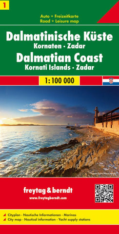
Dalmatinische Küste : Kornaten : Zadar = Dalmatinski obala : Kornati : Zadar = Dalmatische Kust : Kornaten : Zadar
The Dalmatian Coast of Croatia around Zadar and the Kornati Islands on a detailed, indexed map at 1:100,000 from Freytag & Berndt with large icons indicating various facilities including campsites and beaches, ferry connections, etc.
Coverage includes the islands of Kormat, Pasman Ugljan, Dugi Otok and the southern part of Pag. The map shows local roads, highlighting scenic routes, and indicates ferry connections. Icons mark various facilities such as campsites, beaches and marinas, as well as places of interest. The map has latitude and longitude lines at intervals of 5’. The index of place names is on the reverse where a street plan of central Zadar is also provided. Map legend includes English.
The map is an enlargement of cartography prepared at a smaller scale so all place names are in larger print than usually found on similar maps. Please note: this title is not a nautical chart for sailing.
- Product Number: FB_CRO_COAS_1_16
- Reference Product Number: 2053892M
- ISBN: 9783850842976
- Date of Publication: 6/1/2016
- Folded Size: 10.24 inches high by 5.12 inches wide
- Unfolded (flat) Size: 28.35 inches high by 38.98 inches wide
- Map format: Folded
- Map type: Trade Maps - Travel
- Geographical region: Croatia