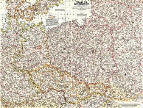
1958 Poland and Czechoslovakia Map
This detailed map of Poland and Czechoslovakia contains notes about territories and administration during the Cold War era. Several boundaries are shown including those before Germanys invasion of Austria and those between communist and non-communist countries. Published in September 1958.
- Product Number: PODHNG_POL_CZ_SK_58
- Reference Product Number: 2321465M
- ISBN: - None -
- Date of Publication: 6/1/1958
- Unfolded (flat) Size: 18.75 inches high by 25 inches wide
- Map format: Wall
- Map type: Trade Maps - Political
- Geographical region: Czechia,Poland,Slovakia