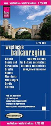
Balkans, Western by Reise Know-How Verlag
Western Balkans 1:725,000 Travel Map, waterproof, GPS-compatible.
This map is waterproof and tear-resistant, double-sided to provide the best balance between a good scale and a convenient sheet size (size 100 x 70 cm / 39.5 x 27.5 in) with topographic and tourist information. Coverage includes all the countries of former Yugoslavia (Slovenia, Croatia, Serbia, Bosnia-Herzegovina, Montenegro, Kosovo and Macedonia), plus Albania. Place names within Serbia are in Latin alphabet only.
Road and rail networks are easy to see on a clear base which presents topography by altitude coloring with contours, spot heights, mountain passes and numerous names of mountain ranges. Road network includes local roads and tracks, and gives driving distances on main and many secondary roads. Ferry routes to the Adriatic islands are also shown.
National parks and protected areas are marked and symbols highlight various places of interest, including campsites, UNESCO world heritage sites, archaeological remains, castles and churches, museums, viewpoints, beaches, ports and marinas, etc. The map has a grid with latitude and longitude at intervals of 20, plus an extensive index of localities. Multilingual map legend includes English. High quality German-made map.
- Product Number: 2184878M
- Product Code: RKH_BALKANS_W
- ISBN: 9783831773107
- Year of Publication: 2015
- Folded Size: 10.24 x 4.72 inches
- Unfolded Size: 35.04 x 27.17 inches
- Map type: Folded Map
- Geographical region: Europe