
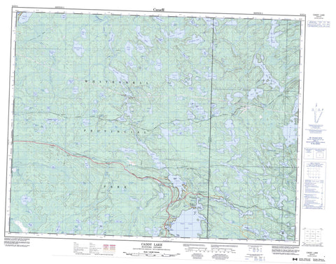
052E14 Caddy Lake Canada topo map, 1:50,000 scale
052E14 Caddy Lake NRCAN topographic map.
Includes UTM and GPS geographic coordinates (latitude and longitude). This 50k scale map is suitable for hiking, camping, and exploring, or you could frame it as a wall map.
Printed on-demand using high resolution, on heavy weight and acid free paper, or as an upgrade on a variety of synthetic materials.
Topos available on paper, Waterproof, Poly, or Tyvek. Usually shipping rolled, unless combined with other folded maps in one order.
- Product Number: NRCAN-052E14
- Parent Topo: TOPO-052E
- Map ID also known as: 052E14, 52E14
- Unfolded Size: Approximately 26" high by 36" wide
- Weight (paper map): ca. 55 grams
- Map Type: POD NRCAN Topographic Map
- Map Scale: 1:50,000
- Geographical region: Manitoba, Canada
Neighboring Maps:
All neighboring Canadian topo maps are available for sale online at 1:50,000 scale.
Purchase the smaller scale map covering this area: Topo-052E
Spatial coverage:
Topo map sheet 052E14 Caddy Lake covers the following places:
- Green Bay - Howe Bay - Indian Bay - Indian Bay - Little Indian Bay - Little Indian Bay - McDougalls Bay - Moonlight Bay - Penniac Bay - Samsons Cove - Miller Beach - Star Beach - Lower Falls - Mallard Falls - McGillivray Falls - Gundy - Noyon - Rice - Hansons Creek Dam - North Cross Lake East Dam - North Cross Lake West Dam - West Hawk Lake Dam - Allum Island - Bert Island - Big Island - Boutilier Island - Fletcher Island - Glooskap Island - John Island - Michihabo Island - Napioa Island - Neve Island - Peanut Island - Alberts Lake - Alice Lake - Allum Lake - Andrew Lake - Ann Lake - Ann Lake - Argue Lake - Astbury Lake - Barbour Lake - Barwood Lake - Bear Lake - Beauchemin Lake - Beauport Lake - Belanger Lake - Bélanger Lake - Berard Lake - Bernard Lake - Beyak Lake - Bigurski Lake - Bishoff Lake - Brant Lake - Bridget Lake - Brown Lake - Caddy Lake - Canoe Lake - Canty Lake - Caribou Lake - Caskey Lake - Chat Lake - Chiesche Lake - Crandall Lake - Doreen Lake - Dott Lake - Drummey Lake - Durban Lake - Emily Lake - Eveline Lake - Florence Lake - Frances Lake - Frazer Lake - Gilmore Lake - Granite Lake - Gundy Lake - Harvey Lake - Hello Lake - Hello Lake - Hesp Lake - Hnatiw Lake - Hop Lake - Indian Lake - Irvine Lake - Jag Lake - Jessica Lake - Kanatan Lake - Kennedy Lake - Kirk Lake - Lake of the Clouds - Lancota Lake - Lingwood Lake - Little Bear Lake - Little Rice Lake - Longpine Lake - Loon Lake - Lost Lake - Macara Lake - Madge Lake - Malachi Lake - Mallard Lake - Man Lake - Mantario Lake - Mantario Lake - Marg Lake - Marion Lake - McGillivray Lake - McQuaker Lake - Michie Lake - Mollie Lake - Moosehead Lake - Muriel Lake - Muth Lake - Nason Lake - Neve Lake - Nora Lake - North Cross Lake - North Scot Lake - Olive Lake - One Stone Lake - Owchar Lake - Peggy Lake - Pelechaty Lake - Pennycook Lake - Pintail Lake - Piute Lake - Rice Lake - Rock Lake - Ross Lake - Rustrock Lake - Sailing Lake - Sanders Lake - Shell Lake - Sherb Lake - Shiaro Lake - Shirley Lake - Simpson Lake - Skogman Lake - Slippery Lake - Somerville Lake - South Cross Lake - South Scot Lake - Spider Lake - Spider Lake - Split Lakes - St. Claire Lake - Star Lake - Staradub Lake - Tannis Lake - T-bone Lake - Teal Lake - Telford Lake - Telford Pond - The Beaver Pond - The Lily Pond - The Pothole - Townsend Lake - Trail Lake - Twin Lake - Vestal Lake - Victoria Lake - Wakus Lake - Watt Lake - West Hawk Lake - West Hawk Lake - Whillier Lake - White Lake - Whitefish Lake - Wilfred Lake - Wing Lake - Wing Lake - Zubek Lake - Alfred Hole Goose Sanctuary - Whiteshell Game Bird Refuge - Whiteshell Provincial Forest - Whiteshell Provincial Park - Manitoba - Bear Creek - Bernard Creek - Castellar Creek - Gundy Creek - Gundy Creek - Hanson Creek - Hansons Creek - Indian Creek - Longpine Creek - Longpine Creek - Malachi Creek - McGillivray Creek - Moss Creek - Nora Creek - North Cross Creek - One Stone Creek - Rennie River - Rice Creek - South Fork Rennie River - Trail Creek - Whiteshell River - Whiteshell River - La Vérendrye Trail - Big Island Landing - Caddy Lake - Cross Lake - Decimal - Ingolf - McDougalls Landing - Ophir - Rice Lake - Star Lake - Telford - White - Winnitoba - Jessica Lake Bog


