
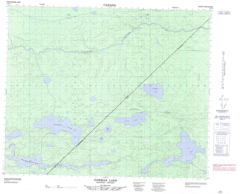
053E02 Gorman Lake Canada topo map, 1:50,000 scale
053E02 Gorman Lake NRCAN topographic map.
Includes UTM and GPS geographic coordinates (latitude and longitude). This 50k scale map is suitable for hiking, camping, and exploring, or you could frame it as a wall map.
Printed on-demand using high resolution, on heavy weight and acid free paper, or as an upgrade on a variety of synthetic materials.
Topos available on paper, Waterproof, Poly, or Tyvek. Usually shipping rolled, unless combined with other folded maps in one order.
- Product Number: NRCAN-053E02
- Parent Topo: TOPO-053E
- Map ID also known as: 053E02, 53E2, 53E02
- Unfolded Size: Approximately 26" high by 36" wide
- Weight (paper map): ca. 55 grams
- Map Type: POD NRCAN Topographic Map
- Map Scale: 1:50,000
- Geographical region: Manitoba, Canada
Neighboring Maps:
All neighboring Canadian topo maps are available for sale online at 1:50,000 scale.
Purchase the smaller scale map covering this area: Topo-053E
Spatial coverage:
Topo map sheet 053E02 Gorman Lake covers the following places:
- Mukwa Narrows - Azure Lake - Baling Fur Lake - Carnegie Lake - Clearwater Lake - Cochram Lake - Fairy Woman Lake - Gorman Lake - Jost Lake - Little File Lake - Mair Lake - Small Swan Lake - Tache Lake - Taché Lake - Warrington Lake - Warrington Lake - Cobham River - Cobham River - Fairy Woman Creek - File River - Gorman River - Gorman River - Grand Portage Creek - Two Legged River - Warrington River - Grand Muskeg


