
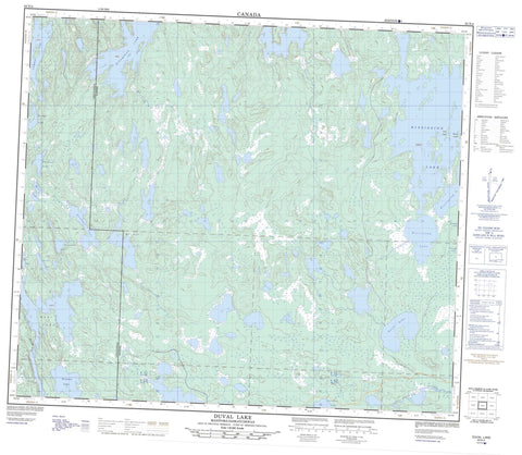
063N04 Duval Lake Canada topo map, 1:50,000 scale
063N04 Duval Lake NRCAN topographic map.
Includes UTM and GPS geographic coordinates (latitude and longitude). This 50k scale map is suitable for hiking, camping, and exploring, or you could frame it as a wall map.
Printed on-demand using high resolution, on heavy weight and acid free paper, or as an upgrade on a variety of synthetic materials.
Topos available on paper, Waterproof, Poly, or Tyvek. Usually shipping rolled, unless combined with other folded maps in one order.
- Product Number: NRCAN-063N04
- Parent Topo: TOPO-063N
- Map ID also known as: 063N04, 63N4, 63N04
- Unfolded Size: Approximately 26" high by 36" wide
- Weight (paper map): ca. 55 grams
- Map Type: POD NRCAN Topographic Map
- Map Scale: 1:50,000
- Geographical region: Manitoba, Canada
Neighboring Maps:
All neighboring Canadian topo maps are available for sale online at 1:50,000 scale.
Purchase the smaller scale map covering this area: Topo-063N
Spatial coverage:
Topo map sheet 063N04 Duval Lake covers the following places:
- Barrett Bay - Jens Bay - Matheson Peninsula - Buckingham Island - Ernie Leech Island - Freemans Island - Jens Island - Moose Island - Zuks Island - Albulet Lake - Beaudry Lake - Cacholotte Lake - Caledon Lake - Duval Lake - Eccles Lake - Forester Lake - French Lake - Gilford Black Lake - Gummerson Lake - Hay Lake - Holopina Lake - Hume Lake - Kipahigan Lake - Kipahigan Lake - Kississing Lake - Mansask Lake - Mansask Lake - Mari Lake - McCormick Lake - Moroz Lake - Newman Lake - Philfoster Lake - Saskman Lake - Saskman Lake - Shapland Lake - Steeds Lake - Surbey Lake - Wizard Lake - Woloski Lake - Bell Hill - McDonald Hill - Kississing River - Little Mikes Creek


