Friesland Province Map
The series of ANWB Tourist Cards is ideal for discovering the sights of the Netherlands. The series of maps is divided into provinces, and this sheet covers Friesland.
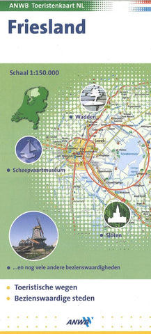
This map shows Friesland at 1: 150,000 (1 cm = 1.5 km), is clearly legible, and has an extensive place name register. Symbols are also displayed on the map, such as parking facilities, viewpoints, nature parks, museums, windmills and castles. Furthermore, many interesting tips are briefly described with the contact details.
- Product Number: ANWB_FRIES_6
- Reference Product Number: 2298289M
- ISBN: 9789018022334
- Date of Publication: 6/1/2006
- Folded Size: 9.5 inches high by 4.5 inches wide
- Unfolded (flat) Size: 27 inches high by 19 inches wide
- Map format: Folded
- Map type: Trade Maps - Bicycling
- Geographical region: Netherlands