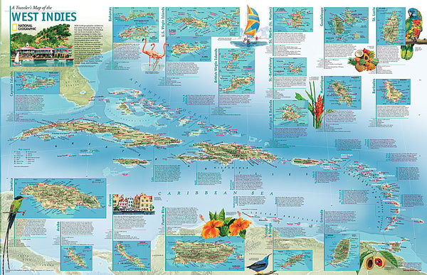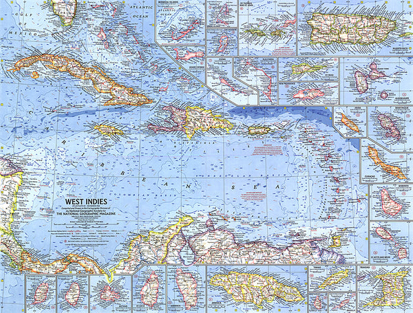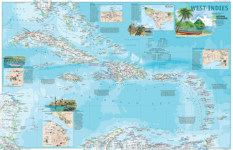
2003 West Indies
This attractive political map shows the many island countries comprising the West Indies and contains inset maps and information for the cities of San Juan, Nassau, Charlotte Amalie, George Town, and Havana. Published in March 2003 as half of a two–map set with A Travelers Map of the West Indies.
- Product Number: PODHNG_W_IND_03
- Reference Product Number: 2321586M
- ISBN: - None -
- Date of Publication: 6/1/2003
- Unfolded (flat) Size: 20 inches high by 31.25 inches wide
- Map format: Wall
- Map type: Trade Maps - Political
- Geographical region: Anguilla,Antigua and Barbuda,Aruba,Bahamas,Barbados,Cayman Islands,Cuba,Curacao,Dominica,Dominican Republic,Grenada,Guadeloupe,Guyana,Haiti,Jamaica,Martinique,Montserrat,Puerto Rico,Saint Barthelemy,Saint Kitts and Nevis,Saint Lucia,Saint Martin,Saint Vincent and the Grenadines,Trinidad and Tobago,Turks and Caicos Islands,Virgin Islands, British,Virgin Islands, United States