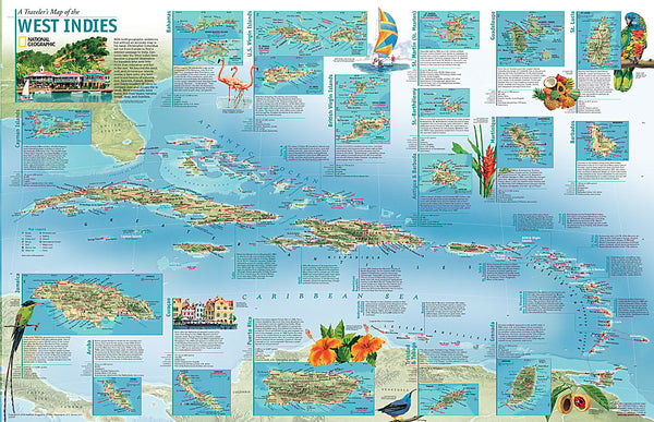
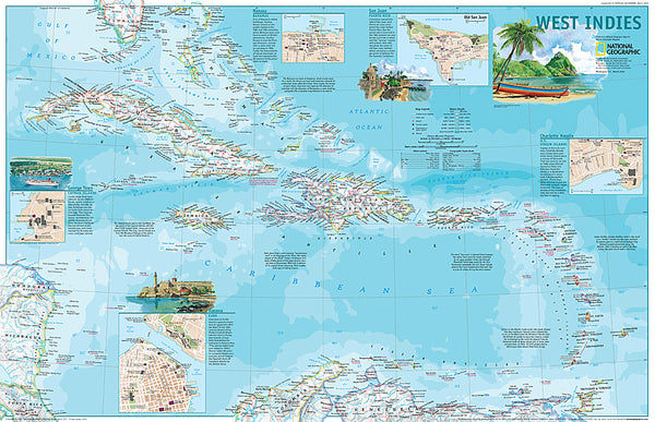
1962 West Indies Map
This colorful and detailed map of the West Indies features inset maps of over two dozen islands, as well as ocean bathymetry, currents, and prevailing winds. Operation Bootstrap was the name given to ambitious projects which rapidly industrialized Puerto Rico in the 1950s, shifting the regions economy from agriculture to manufacturing. Published in December 1962 with the article Puerto Ricos Seven-league Bootstraps.
- Product Number: PODHNG_W_IND_62
- Reference Product Number: 2321548M
- ISBN: - None -
- Date of Publication: 6/1/1962
- Unfolded (flat) Size: 19 inches high by 25 inches wide
- Map format: Wall
- Map type: Trade Maps - Political
- Geographical region: Anguilla,Antigua and Barbuda,Aruba,Bahamas,Barbados,Cayman Islands,Cuba,Curacao,Dominica,Dominican Republic,Grenada,Guadeloupe,Guyana,Haiti,Jamaica,Martinique,Montserrat,Puerto Rico,Saint Barthelemy,Saint Kitts and Nevis,Saint Lucia,Saint Martin,Saint Vincent and the Grenadines,Trinidad and Tobago,Turks and Caicos Islands,Virgin Islands, British,Virgin Islands, United States