
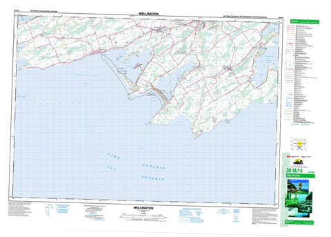
030N14 Wellington Canada topo map, 1:50,000 scale
030N14 Wellington NRCAN topographic map.
Includes UTM and GPS geographic coordinates (latitude and longitude). This 50k scale map is suitable for hiking, camping, and exploring, or you could frame it as a wall map.
Printed on-demand using high resolution, on heavy weight and acid free paper, or as an upgrade on a variety of synthetic materials.
Topos available on paper, Waterproof, Poly, or Tyvek. Usually shipping rolled, unless combined with other folded maps in one order.
- Product Number: NRCAN-030N14
- Parent Topo: TOPO-030N
- Map ID also known as: 030N14, 30N14
- Unfolded Size: Approximately 26" high by 36" wide
- Weight (paper map): ca. 55 grams
- Map Type: POD NRCAN Topographic Map
- Map Scale: 1:50,000
- Geographical region: Ontario, Canada
Neighboring Maps:
All neighboring Canadian topo maps are available for sale online at 1:50,000 scale.
Purchase the smaller scale map covering this area: Topo-030N
Spatial coverage:
Topo map sheet 030N14 Wellington covers the following places:
- Athol Bay - Flakes Cove - Gull Pond - Halfmoon Bay - Huyck Bay - Huycks Bay - Pleasant Bay - Prince Edward Bay - Smith Bay - Soup Harbour - South Bay - Wellington Bay - Gull Bar - Petticoat Bar - Charwell Point - Flatt Point - Grenade Point - Hawthorn Point - Huyck Point - Huycks Point - Owen Point - Petticoat Point - Pickerel Point - Point Petre - Salmon Point - Spencer Point - Van Dousens Point - West Point - Wicked Point - Prince Edward - Ameliasburgh - Athol - Hallowell - Hillier - Marysburgh - North Marysburgh - Prince Edward - South Marysburgh - Cat Island - Garratt Island - Gasket Island - Hickory Island - Hickory Islands - Jobs Island - Johnston Island - Parr Island - Poplar Island - Sheba's Island - Tubbs Island - Bloomfield Mill Pond - Consecon Lake - East Lake - Lac Ontario - Lake Ontario - Mill Pond - West Lake - McMahon Bluff - Ameliasburgh - Athol - Hallowell - Hillier - Marysburgh - North Marysburgh - Sophiasburgh - South Marysburgh - Beaver Meadow Conservation Area - Macaulay Mountain Conservation Area - Milford Mill Pond Conservation Area - Sandbanks Provincial Park - Black Creek - Black River - Bloomfield Creek - Hubbs Creek - Marsh Creek - Outlet River - McFaul Shoal - Palen Bank - The Sandbanks - Wicked Bank - Athol - Black Creek - Black River Bridge - Bloomfield - Cherry Valley - Cove Beach - Hallowell - Hillcrest - Hillier - Hubbs - Milford - Niles Corners - Outlet - Picton - Point Petre - Port Milford - Rosehall - Salmon Point - Sand Banks - South Bay - The Outlet - Warings Corner - Waupoos - Wellington - West Lake - Woodrous


