
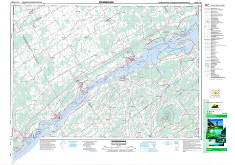
031B14 Morrisburg Canada topo map, 1:50,000 scale
031B14 Morrisburg NRCAN topographic map.
Includes UTM and GPS geographic coordinates (latitude and longitude). This 50k scale map is suitable for hiking, camping, and exploring, or you could frame it as a wall map.
Printed on-demand using high resolution, on heavy weight and acid free paper, or as an upgrade on a variety of synthetic materials.
Topos available on paper, Waterproof, Poly, or Tyvek. Usually shipping rolled, unless combined with other folded maps in one order.
- Product Number: NRCAN-031B14
- Parent Topo: TOPO-031B
- Map ID also known as: 031B14, 31B14
- Unfolded Size: Approximately 26" high by 36" wide
- Weight (paper map): ca. 55 grams
- Map Type: POD NRCAN Topographic Map
- Map Scale: 1:50,000
- Geographical region: Ontario, Canada
Neighboring Maps:
All neighboring Canadian topo maps are available for sale online at 1:50,000 scale.
Purchase the smaller scale map covering this area: Topo-031B
Spatial coverage:
Topo map sheet 031B14 Morrisburg covers the following places:
- Cook Bay - Flagg Bay - Mariatown Bay - Marina Bay - Stata's Bay - Crysler Beach - Iroquois Beach - Morrisburg Beach - Cooks Point - Dawsons Point - Doran Point - Iroquois Point - Macdonald Point - Pinetree Point - Point Iroquois - Rapide Plat Point - Robertson Point - Tuttle Point - Weaver Point - Whitney Point - Windmill Point - North Channel - The Gut - Dundas - Edwardsburgh - Grenville - Matilda - Mountain - Osnabruck - South Gower - Stormont - Williamsburgh - Ault Drain - Barkley Drain - Barkley-Johnson Drain - Beckstead Drain - Beggs-Barkley Drain - Beggs-Workman Drain - Brown Drain - Casselman-Dawley Drain - Charles M. Whittaker Drain - Cooper-Thompson Drain - D. Beckstead Drain - Devlin Drain - Donald Hanes Drain - English Drain - Ferguson Drain - Foster Drain - Gogo Drain - Joe Channette Drain - Joe Shannette Drain - Marselis Drain - Mattice Drain - McMartin Drain - Moffatt-Fetterly Drain - Monroe Drain - S.I. Casselman Drain - Saddlemire Drain - Shaver-Harper Municipal Drain - Southworth-Gallinger Drain - Thompson-Errington Drain - Thorpe-Ellis Drain - Van Moorsell Drain - Whittaker Drain - Wilson Drain - Zeron Drain - Akwesasne Indian Reserve 59 - Réserve indienne Akwesasne 59 - Adams Island - Ault Island - Ault Island - Broder Island - Canada Island - Doran Island - Drummond Island - Duck Island - Grass Island - Harkness Island - Indian Island - Iroquois Island - Lame Squaw Island - Macdonald Island - Morrison Island - Morrison Island - Nairn Island - Nairne Island - Pier Island - Presqu'ile - Prison Island - Sheek Island - Spencer Island - St. John Island - Steen Island - Toussaint Island - Lake St. Lawrence - Farran Point Canal - Galop Canal - Old Galop Canal - Rapide Plat Canal - United Counties of Leeds and Grenville - United Counties of Stormont, Dundas and Glengarry - Cornwall - Edwardsburgh - Edwardsburgh/Cardinal - Matilda - Mountain - North Dundas - North Grenville - Osnabruck - Oxford-on-Rideau - South Dundas - South Gower - South Stormont - Williamsburgh - Winchester - Parc national du Canada des Îles-du-Saint-Laurent - Refuge d'oiseaux du Haut-Canada - St. Lawrence Islands National Park of Canada - Upper Canada Bird Sanctuary - Ontario - Galop Rapids - Rapide Plat - Ault Creek - Aultsville Creek - Black Creek - Cook Creek - Doran Creek - Drivers Creek - Flagg Creek - Fleuve Saint-Laurent - Hilliards Creek - Hilliards Creek - Hoasic Creek - Johnstown Creek - McLaughlins Creek - Millers Creek - Nash Creek - Parlow Creek - Rivière Nation - Sandy Creek - Sawmill Creek - South Branch South Nation River - South Nation River - St. Lawrence River - Stata's Creek - Toyes Creek - Doran Shoal - Frazer Shoal - Jackass Shoal - Prunner Shoal - Steen Shoal - Weaver Shoal - Archer - Aultsville - Bouckhill - Boucks Hill - Brinston - Brouseville - Cardinal - Cedar Grove - Crystal Rock - Dixons Corners - Dundela - East Williamsburg - Farran's Point - Froatburn - Froatsburn - Glen Becker - Glen Stewart - Haddo - Hainsville - Hoasic - Hulbert - Ingleside - Irena - Iroquois - Johnstown - Mainsville - Mariatown - Morrisburg - Morrisburg Station - Muttonville - New Ross - Nudell Bush - Pittston - Pleasant Valley - Riverside - Riverside Heights - Rowena - Shanly - Silver City - South Mountain - Stampville - Straders Hill - Toyehill - Toyes Hill - Wexford - Williamsburg


