
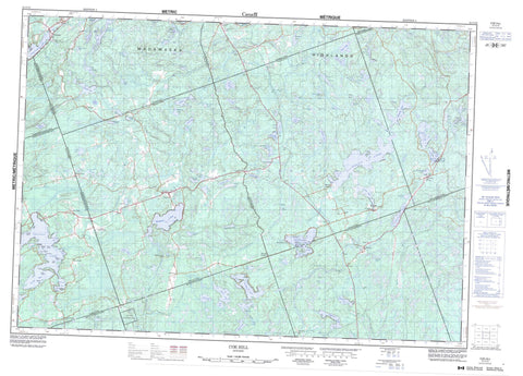
031C13 Coe Hill Canada topo map, 1:50,000 scale
031C13 Coe Hill NRCAN topographic map.
Includes UTM and GPS geographic coordinates (latitude and longitude). This 50k scale map is suitable for hiking, camping, and exploring, or you could frame it as a wall map.
Printed on-demand using high resolution, on heavy weight and acid free paper, or as an upgrade on a variety of synthetic materials.
Topos available on paper, Waterproof, Poly, or Tyvek. Usually shipping rolled, unless combined with other folded maps in one order.
- Product Number: NRCAN-031C13
- Parent Topo: TOPO-031C
- Map ID also known as: 031C13, 31C13
- Unfolded Size: Approximately 26" high by 36" wide
- Weight (paper map): ca. 55 grams
- Map Type: POD NRCAN Topographic Map
- Map Scale: 1:50,000
- Geographical region: Ontario, Canada
Neighboring Maps:
All neighboring Canadian topo maps are available for sale online at 1:50,000 scale.
Purchase the smaller scale map covering this area: Topo-031C
Spatial coverage:
Topo map sheet 031C13 Coe Hill covers the following places:
- Adam's Bay - Austin's Bay - Caverly's Bay - Gilmour Bay - Mud Bay - Prouty Bay - South Bay - Walkes Bay - Winter Bay - Gilmour Point - Renwick Point - Sunset Point - The Headland - Cardiff - Cashel - Chandos - Dungannon - Faraday - Grimsthorpe - Haliburton - Hastings - Lake - Limerick - Mayo - Methuen - Peterborough - Tudor - Wollaston - Bateman's Island - Belle Island - Big Pine Island - Buck Island - Burnt Island - Crab Island - Dewey's Island - Garden Island - Johnston Island - Little Pine Island - Little Rock - Paudash Island - Picket Island - Powers Island - Quality Island - Standish Island - Allen Lake - Aryhart Lake - Bald Lake - Batelle Lake - Baytree Lake - Bea Lake - Bear Lake - Bear Shanty Lake - Blue Sea Lakes - Bob's Lake - Brett Lake - Brinklow Lake - Brooks Lake - Buttermilk Lake - Cashel Lake - Castoroil Lake - Cedar Lake - Chain Lakes - Chandos Lake - Coe (Island) Lake - Conlin Lake - Cranberry Lake - Currie Lake - Dark Lake - Deception Lake - Dickey Lake - Dixon Lake - Door Lake - Drumm Lake - Duck Lake - East Tommy Lake - Egan Lake - Finnegan Lake - Freen Lake - Gaffney Lake - Gilroy Lake - Glanmire Lake - Grandpop's Lake - Gunter Lake - Hamm Lake - Hardwood Lake - Henderson Lake - Hinchcliffe Lake - Horse Lake - Horseshoe Lake - Imp Lake - Jimmie Lake - Jocko Lake - John Lake - Jordan Lake - Kings Lake - Lake of Islands - Lasswade Lake - Laundry Lake - Lavallée Lake - Lighthouse Lake - Limerick Lake - Little Loon Lake - Little Sanford Lake - Little Skunk Lake - Little Trout Lake - Little Wadsworth Lake - Long Lake - Lower Paudash Lake - Lucerne Lake - Lucid Lake - Mawson Lake - McCallum Lake - McFee Lake - McMurray Lake - Mephisto Lake - Mountain Lake - Mud Lake - Muskrat Lake - Neil Lake - North Finnegan Lake - North Lake - Northwest Perch Lake - Paddy's Lake - Perch Lake - Perch Lake - Peter Lake - Pine Lake - Pond Lily Lake - Powers Lake - Ragged Lake - Riddles Lake - Robinson Lake - Rock Lake - Salt Lake - Sanford Lake - Sargent Lake - Second Lake - Sexsmith Lake - Shaw Lake - Snow Lake - Spring Lake - St. Ola Lake - Steen Lake - Steenburg Lake - Sweets Lake - Taits Lake - Thanet Lake - The Twins - Third Lake - Tommy Lake - Townsend Lake - Trits Lake - Twait's Lake - Twinpine Lakes - Twomile Lake - Upper Trout Lake - Urbach Lake - Vader Lake - Vance Lake - Wadsworth Lake - Wendsley Lake - West Lake - Wollaston Lake - Woods Lake - Madawaska Highlands - Haliburton - Hastings - Peterborough - Belmont and Methuen - Bicroft - Burleigh and Anstruther - Burleigh-Anstruther-Chandos - Cardiff - Carlow - Carlow/Mayo - Chandos - Dungannon - Elzevir and Grimsthorpe - Faraday - Glamorgan - Havelock-Belmont-Methuen - Highlands East - Hungerford - Limerick - Marmora - Marmora and Lake - Mayo - Monmouth - North Kawartha - Tudor and Cashel - Tweed - Wollaston - Crowe River Swamp Conservation Reserve - Aide Creek - Bass Creek - Bear Shanty Creek - Beaver Creek - Black River - Coburn Creek - Crowe River - Deer River - Dickey Creek - Dixon Creek - Egan Creek - Faraday Creek - Glanmire Creek - Jordan River - L'Amable Creek - Little Jordan Creek - Mephisto Creek - Moira River - Mud Creek - Nicholsons Creek - North River - Russel Creek - Steen Creek - Steenburg Creek - Steenburg Creek - West Black River - Bancroft - Brinklow - Coe Hill - Egan Creek - Egan Creek Siding - Faraday - Gilmour - Glanmire - Glen Alda - Gunter - Lake - Lasswade - Martins Landing - McDonalds - Murphy Corners - Ormsby - Ormsby Junction - Owenbrook - Paudash - Rose Island - St. Ola - St. Ola Station - Steenburg - Steenburg Lake - The Ridge - Turriff - Umfraville - Phillip's Marsh - Sargent Marsh


