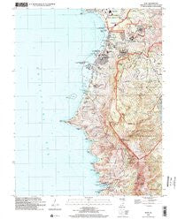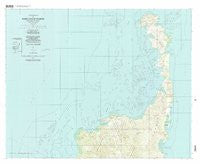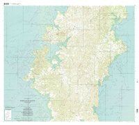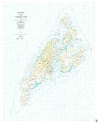
~ Yap Islands Waqab FM topo map, 1:25000 scale, 7.5 X 7.5 Minute, Historical, 1983, updated 1983
Yap Islands Waqab , Federated States of Micronesia, USGS topographic map dated 1983.
Includes geographic coordinates (latitude and longitude). This topographic map is suitable for hiking, camping, and exploring, or framing it as a wall map.
Printed on-demand using high resolution imagery, on heavy weight and acid free paper, or alternatively on a variety of synthetic materials.
Topos available on paper, Waterproof, Poly, or Tyvek. Usually shipping rolled, unless combined with other folded maps in one order.
- Product Number: USGS-5930075
- Free digital map download (high-resolution, GeoPDF): Yap Islands Waqab , Federated States of Micronesia (file size: 19 MB)
- Map Size: please refer to the dimensions of the GeoPDF map above
- Weight (paper map): ca. 55 grams
- Map Type: POD USGS Topographic Map
- Map Series: HTMC
- Map Verison: Historical
- Cell ID: 76773
- Scan ID: 462325
- Imprint Year: 1983
- Woodland Tint: Yes
- Aerial Photo Year: 1969
- Edit Year: 1983
- Field Check Year: 1980
- Datum: Guam 1963
- Map Projection: Universal Transverse Mercator
- Map published by United States Geological Survey
- Map Language: English
- Scanner Resolution: 600 dpi
- Map Cell Name: Yap Islands (Waqab)
- Grid size: 7.5 X 7.5 Minute
- Date on map: 1983
- Map Scale: 1:25000
- Geographical region: Federated States of Micronesia, United States
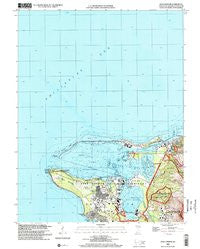
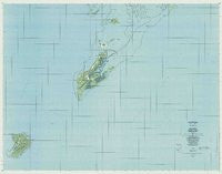
Neighboring Maps:
All neighboring USGS topo maps are available for sale online at a variety of scales.
Spatial coverage:
Topo map Yap Islands Waqab , Federated States of Micronesia, covers the geographical area associated the following places:
- Beenik - Qadibweg - Guruung - Weenfaraq - Ngathaaw' - Binaew - Wanead - Dariikaan - Ruuq - Qoon - Maaq - Daabaab - Tooraaq - Kadaay - Thool - Baqanimaqut - Gachalaaw - Goqchol - Dechumur - Munguuy - Liil - Maqanpaaq - Malaaf - Luweech - Qatliw - Wugeem - Fiteadooq - Rimiit - Faneakaan - Gaqnaqun - Maabuuq - Daabach - Bunuknuk - Ruun'uw - Dingiin - Micheew - Qamin - Maaq - Derraak - Mussiilog - Qamun - Rupgeed - Baleabaat' - N'eef - Madargil - Toeruw - Darachaq - Ngolog - Faraq - Gitaem - Palaaw - Machangad - Laay - Worwoq - Feeduqor - Raeng - Qichigiyoeg - Muyuub - Wuluug - Ngoof - Mineef - Maaloon - Leebinaew - Maedriich - Gael' - Yabach - Qabyaang - Bulwol - Kanif - Rueechayaam - Faal - Thabeeth - Binaew - Doqomchuuy - Lamear - Riikeen - Dugor - Laay - Magachgil - Magaaf - Deafqorean - Bechyal - Mulroq - Qeang - Meer - Numnung - Woriilaq - Qanooth - Ruwaamaaw' - Numdul - Loothog - Tayey - Neel - Mireeniiw - Ngariy - Rumuug - Malawaay - Meqruur - Qeedugor - Dinaey
- Map Area ID: AREA9.66666679.4083333138.025138.225
- Northwest corner Lat/Long code: USGSNW9.6666667138.025
- Northeast corner Lat/Long code: USGSNE9.6666667138.225
- Southwest corner Lat/Long code: USGSSW9.4083333138.025
- Southeast corner Lat/Long code: USGSSE9.4083333138.225
- Northern map edge Latitude: 9.6666667
- Southern map edge Latitude: 9.4083333
- Western map edge Longitude: 138.025
- Eastern map edge Longitude: 138.225