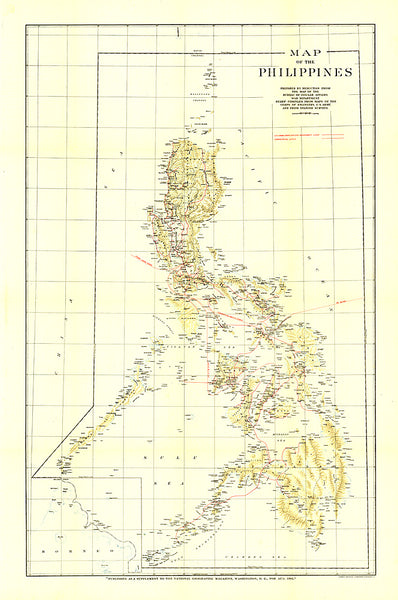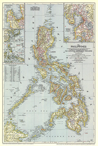
1945 Philippines Map
The Philippines were liberated from the Japanese by MacArthurs forces just months before this map was published in March 1945. This map, which accompanied the article What Luzon Means to Uncle Sam, features the provinces and their capitals as well as airfields. A fine collectible for those interested in World War II era maps.
- Product Number: PODHNG_PHIL_45
- Reference Product Number: 2321359M
- ISBN: - None -
- Date of Publication: 6/1/1945
- Unfolded (flat) Size: 26 inches high by 17.5 inches wide
- Map format: Wall
- Map type: Trade Maps - Political
- Geographical region: Philippines