
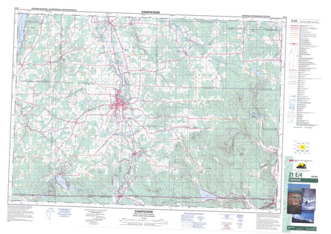
021E04 Coaticook Canada topo map, 1:50,000 scale
021E04 Coaticook NRCAN topographic map.
Includes UTM and GPS geographic coordinates (latitude and longitude). This 50k scale map is suitable for hiking, camping, and exploring, or you could frame it as a wall map.
Printed on-demand using high resolution, on heavy weight and acid free paper, or as an upgrade on a variety of synthetic materials.
Topos available on paper, Waterproof, Poly, or Tyvek. Usually shipping rolled, unless combined with other folded maps in one order.
- Product Number: NRCAN-021E04
- Parent Topo: TOPO-021E
- Map ID also known as: 021E04, 21E4, 21E04
- Unfolded Size: Approximately 26" high by 36" wide
- Weight (paper map): ca. 55 grams
- Map Type: POD NRCAN Topographic Map
- Map Scale: 1:50,000
- Geographical region: Quebec, Canada
Neighboring Maps:
All neighboring Canadian topo maps are available for sale online at 1:50,000 scale.
Purchase the smaller scale map covering this area: Topo-021E
Spatial coverage:
Topo map sheet 021E04 Coaticook covers the following places:
- Baie Kate - Baie Morse - Baie Perkins - Baie Woodland - Plage du Lac Lyster - Plage Whitcomb - Pointe Black - Pointe Jensen - Pointe Kate - Pointe Morse - Pointe Perkins - Bromptonville - Coaticook - Fleurimont - Lennoxville - Rock Forest - Sherbrooke - La Grande Côte - Chute à Donat - Chutes à Donat - Chutes Cushing - Auckland - Barford - Barnston - Clifton - Coaticook - Compton - Hatley - Hereford - Saint-Edmond - Sainte-Edwige - Sainte-Suzanne - Saint-Henri - Saint-Herménégilde - Saint-Jean-l'Évangéliste - Saint-Luc - Saint-Malo - Saint-Marc - Saint-Mathieu - Saint-Matthieu - Saint-Thomas-d'Aquin - Barrage à Mathieu - Barrage de Dixville - Barrage de la Belding-Corticelli - Barrage du Lac-Lippé - Barrage Haseltine - Barrage Lafagir-1 - Barrage Lafagir-2 - Barrage Lafagir-3 - Barrage Lafagir-4 - Barrage Lyster - Barrage Penman - Barrage Rémillard - Barrage Saint-Paul - Centrale Penman - Rocher Castle - Rocher du Sphinx - Baldwin Pond - Étang à Caron - Étang Cloutier - Étang de la Cuvette - Étang de la Moulac - Étang Duck - Étang Duck - Étang Jean-Marie - Étang Lanciaux - Étang Line - Étang Mort - Étang Mud - Étang Sheehy - Étang St-Louis - Étangs Madore - Étangs Richard - Étangs Séguin - Lac à Mathieu - Lac à Robert - Lac Barnston - Lac Cotnoir - Lac de la Parenté - Lac des Français - Lac Duquette - Lac Hatley - Lac Labbé - Lac Leaches - Lac Lindsay - Lac Lippé - Lac Lyster - Lac Massawippi - Lac Wallace - Lac Wheeler - LacRémillard - Mud Pond - Petit étang de la Carrière - Petit lac Baldwin - Petit lac Ouimet - Belvédère Richard-Baldwin - Halte de l'Eau-Vive - Notre-Dame-de-la-Salette - Passerelle de l'Arc-des-Piétons - Saint-Wilfrid - Stationpiscicole de Baldwin - Barnston Hill - Buttes à Nolin - Colline Chabot - Colline Spring - Colline Théroux - La Black Cat - La Pigeon Hill - La Tom-Black Ridge - Le Pinacle - Mont Barnston - Mont Goblet - Mont Green Goblet - Mont Hereford - Mont Séguin - Mont Tanguay - Montagne à Brunelle - Coaticook - Memphrémagog - Lieu historique national du Canada Louis-S.-St-Laurent - Louis S. St. Laurent National Historic Site of Canada - Parc Boisjoli - Parc Carillon - Parc Chartier - Parc Couillard - Parc de la Gorge-de-Coaticook - Parc de récréation de la Gorge-de-Coaticook - Parc du Club-Lions - Parc du Curé-Chartier - Parc H.-F.-Baldwin - Parc Kennedy - Parc Municipal - Parc Récréatif - Parc Shurtleff - Parc Yvon-Lemieux - Quebec - Branche Lachance - Cours d'eau Bergeron - Cours d'eau Biron - Cours d'eau Bissonnette - Cours d'eau Bourgoin - Cours d'eau Bourquard - Cours d'eau Chabert - Cours d'eau Champagne - Cours d'eau Charest - Cours d'eau Cloutier - Cours d'eau Ferland - Cours d'eau Giroux - Cours d'eau Grenier - Cours d'eau Lafond - Cours d'eau Legrand - Cours d'eau Ménard - Cours d'eau Riendeau - Cours d'eau Rodrigue - Cours d'eau Saint-James - Cours d'eau Sylvestre - Cours d'eau Vaillancourt - Cours d'eau Viens - Décharge du Lac Duquette - Décharge du Lac Lyster - Rivière Ascot - Rivière aux Saumons - Rivière Clifton - Rivière Coaticook - Rivière Hall - Rivière Moe - Rivière Moes - Rivière Niger - Rivière Nigger - Rivière Tomifobia - Ruisseau à Chabot - Ruisseau Abbott - Ruisseau Adam - Ruisseau Audet - Ruisseau Averill - Ruisseau Ball - Ruisseau Beau Porc - Ruisseau Beaulieu - Ruisseau Bélanger - Ruisseau Boisvert - Ruisseau Bradley - Ruisseau Brandy - Ruisseau Brook - Ruisseau Brûlé - Ruisseau Buck - Ruisseau Chaloux - Ruisseau Cotnoir - Ruisseau Cushing - Ruisseau de la Meder - Ruisseau de Ladd's Mills - Ruisseau des Bobines - Ruisseau du Pont Rouge - Ruisseau du Veuf - Ruisseau Dubois - Ruisseau Dupont - Ruisseau Fecteau - Ruisseau Fontaine - Ruisseau Gooley - Ruisseau Goose Neck - Ruisseau Hébert - Ruisseau Howe - Ruisseau Lachapelle - Ruisseau Leach - Ruisseau Madore - Ruisseau Major - Ruisseau May - Ruisseau Montminy - Ruisseau Moreau - Ruisseau Mosher Meadow - Ruisseau Noir - Ruisseau Perreault - Ruisseau Pfeuti - Ruisseau Pope - Ruisseau Pratt - Ruisseau Prince - Ruisseau Routhier - Ruisseau Sévigny - Ruisseau Thomas-Van Dyke - Ruisseau Thompson - Ruisseau Thomson - Ruisseau Tremblay - Ruisseau Veillette - Ruisseau Wells - Ruisseau William - Chemin de la Côte-Plante - Côte Bank - Côte de la Pointe - Côte de la Traverse-du-1er-Rang - Côte de Malvina - Côte du 1er-Rang - Côte du Chemin-du-Lac - Côte du Rang-C - Côte Plante - Pont à Jean - Pont Archie - Pont Baldwin - Pont Belouin - Pont Carbonneau - Pont Chartier - Pont chez Jacques - Pont chez Ti-Kiss - Pont de Cèdre - Pont de Ciment - Pont de Hyatt's Mills - Pont de la Main - Pont de la Station - Pont de l'Allée-des-Marchands - Pont de l'École - Pont de Moes River - Pont de Moe's River - Pont des Pionniers - Pont du Village - Pont Gilmour - Pont Haskell - Pont Houle - Pont Johann - Pont Josephine-Bean - Pont Lafond - Pont Laperle - Pont Lynch - Pont Morgan - Pont Narcisse-Beloin - Pont Rouge - Pont Saint-Jean-Baptiste - Pont Saint-Marc - Pont Saint-Paul - Pont suspendu de la Gorge - Pont Tremblay - Pont Trudeau - Pont Vaillancourt - Pont Wellington - Pont Yves - La Piscine à Tarzan - Compton - Dixville - East Hatley - Hatley - Baldwin Mills - Barford - Barnston - Barrage-Hopkins - Boudreau-Corners - Charrington - Coaticook - Coaticook-Nord - Comins Mills - Compton - Corliss - Dixville - East Hereford - East Hereford - Gosselin-Mills - Hatley Centre - Heathton - Hereford - Hereford Hill - Hillhurst - Hyatt's Mills - Kilburn Mills - Kingscroft - La Cave - La Slouce - Lac-Wallace - Ladd's Mills - Les Collines-Paisibles - Libbytown - Massawippi - Moes River - Moe's River - Perryboro - Rivard - Rivard-Corners - Sainte-Edwidge - Sainte-Edwidge - Saint-Herménégilde - Saint-Malo - South Barnston - Stanhope - Stanhope - Tanguay - Villette - Ways Mills - Way's Mills - Gorge de Coaticook - Gorges de Coaticook - La Meder - Ascot - Auckland - Aukland - Barford - Barnston - Barnston-Ouest - Brompton - Clifton-Partie-Est - Compton - Compton - Compton Station - Deauville - Dixville - East Hereford - Hatley - Hatley - Hatley-Partie-Ouest - Hereford - Martinville - Sainte-Catherine-de-Hatley - Sainte-Edwidge-de-Clifton - Saint-Élie-d'Orford - Saint-Herménégilde - Saint-Isidore-d'Auckland - Saint-Isidore-de-Clifton - Saint-Malo - Saint-Mathieu-de-Dixville - Saint-Venant-de-Hereford - Saint-Venant-de-Paquette


