
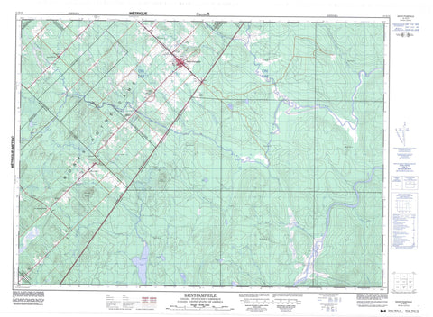
021K13 Saint Pamphile Canada topo map, 1:50,000 scale
021K13 Saint Pamphile NRCAN topographic map.
Includes UTM and GPS geographic coordinates (latitude and longitude). This 50k scale map is suitable for hiking, camping, and exploring, or you could frame it as a wall map.
Printed on-demand using high resolution, on heavy weight and acid free paper, or as an upgrade on a variety of synthetic materials.
Topos available on paper, Waterproof, Poly, or Tyvek. Usually shipping rolled, unless combined with other folded maps in one order.
- Product Number: NRCAN-021K13
- Parent Topo: TOPO-021K
- Map ID also known as: 021K13, 21K13
- Unfolded Size: Approximately 26" high by 36" wide
- Weight (paper map): ca. 55 grams
- Map Type: POD NRCAN Topographic Map
- Map Scale: 1:50,000
- Geographical region: Quebec, Canada
Neighboring Maps:
All neighboring Canadian topo maps are available for sale online at 1:50,000 scale.
Purchase the smaller scale map covering this area: Topo-021K
Spatial coverage:
Topo map sheet 021K13 Saint Pamphile covers the following places:
- Saint-Pamphile - Chutes à Jos-Lord - Arago - Casgrain - Dionne - Garneau - Leverrier - Saint-Adalbert - Sainte-Félicité - Saint-Pamphile - Talon - Lac à Jos-Blanchet - Lac à Sevère - Lac Bucholtz - Lac du Caribou - Lac Leverrier - Lac Maringouin - Le Calvaire - Montagne Bellevue - Rapides du Jarret d'Orignal - Big Black River - Branche Lemay - Cours d'eau Jalbert - Cours d'eau Lord - Grande rivière Calder - Grande rivière Noire - Grande rivière Noire Est - Le Gros Ruisseau - Petite rivière Noire - Petite rivière Saint-Roch - Rivière à la Truite - Rivière à l'Orignal - Rivière Brown - Rivière de la Savane - Rivière des Eaux Mortes - Rivière des Eaux Mortes Sud - Rivière des Gagnon - Rivière du Gué - Rivière du Rochu - Rivière Gobeil - Rivière Grand Calder - Rivière Leverrier - Rivière Maringouin - Rivière Saint-Roch - Ruisseau à Ernest-Vaillancourt - Ruisseau à Gédéon-Vaillancourt - Ruisseau à Ti-Brod - Ruisseau à Ti-Louis - Ruisseau Calder - Ruisseau chez Clother - Ruisseau de la Frontière - Ruisseau Dumas - Ruisseau Froid - Ruisseau Glazier - Ruisseau Good - Ruisseau Mort - Ruisseau Mort Sud - Ruisseau Rocheux - Ruisseau Saint-Amant - Ruisseau Shields - Côte à Blanchet - Côte à Camel - Côte à Edmond - Côte à Maxime - Côte à Nadeau - Côte à Paradis - Côte à Turcotte - Côte chez Jérémie - Côte chez Noré - Côte de la Rivière-Noire - Côte des Érables - Côte des Sauvages - Côte du Calvaire - Pont du Sault - L'Équerre - Les Quatre-Chemins - Saint-Adalbert - Sainte-Félicité-de-L'Islet - Saint-Pamphile - Saint-Adalbert - Sainte-Euphémie-sur-Rivière-du-Sud - Sainte-Félicité - Sainte-Lucie-de-Beauregard - Sainte-Perpétue - Saint-Marcel - Saint-Omer


