1949 British Isles Map
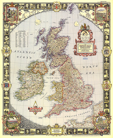
With its elaborate, illustrated border and stylish legend, this map of the British Isles was made for framing. Published in April 1949, it is both a work of art as well as an informative map, containing an abundance of places of interest including cathedrals, ruins, battlefields, and more.
- Product Number: PODHNG_UK_49
- Reference Product Number: 2321460M
- ISBN: - None -
- Date of Publication: 6/1/1949
- Unfolded (flat) Size: 32.25 inches high by 26.5 inches wide
- Map format: Wall
- Map type: Trade Maps - Political
- Geographical region: United Kingdom