
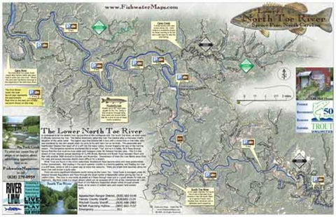
Lower North Toe Fishing Map
The Lower North Toe River is a top shelf smallmouth bass fishery and a fantastic river to float in either a canoe, drift boat, or personal watercraft. Our full color, waterproof map and fly fishing guide measures 11? x 17? and shows the river from Spruce Pine to the confluence with the South Toe where the river becomes the Nolichucky and has all the info you need to get on the water, including hatch charts, recommended flies, access points, put-in / take-outs, float times, parking locations, and local information.
- Product Number: FW_LOWER_N_TOE_10
- Reference Product Number: 2336134M
- ISBN: - None -
- Date of Publication: 1/1/2010
- Unfolded (flat) Size: 11 inches high by 5.75 inches wide
- Map format: Folded
- Map type: Trade Maps - Fishing
- Geographical region: United States
- Geographical subregion: North Carolina


