
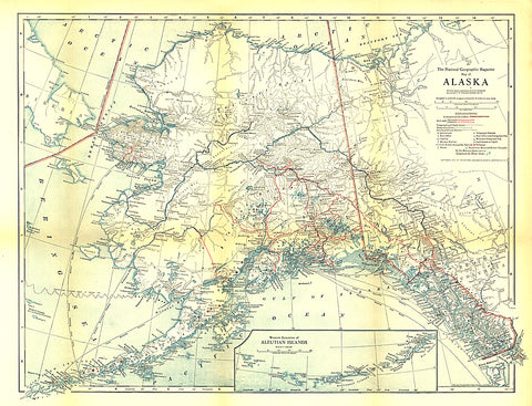
1914 Alaska Map
Published in February 1914 with the article The Nations Undeveloped Resources, the Map of Alaska contains an abundance of details showing the growing human settlement of the region. U.S. public schools for natives, post offices, telegraph stations, mail routes, and mission stations are just some of the many features shown on this map.
- Product Number: PODHNG_US_AK_14
- Reference Product Number: 2321666M
- ISBN: - None -
- Date of Publication: 6/1/1914
- Unfolded (flat) Size: 16.5 inches high by 21.5 inches wide
- Map format: Wall
- Map type: Trade Maps - Political
- Geographical region: United States
- Geographical subregion: Alaska


