
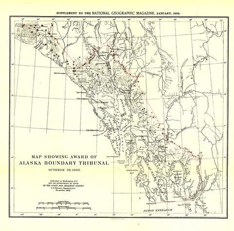
1904 Map Showing Award of Alaska Boundary Tribunal of 1896
The Map Showing Award of Alaska Boundary Tribunal, October 2, 1896 was drawn on October 20, 1903 and appeared in National Geographic Magazine in January 1904 with an article on the Alaska Boundary Tribunal. The boundary separating the Alaskan Panhandle from British Columbia had been in dispute for many years. A decision was finally reached in 1903 by a tribunal of U.S., Canadian, and British officials.
- Product Number: PODHNG_US_AK_BOUN_04
- Reference Product Number: 2321664M
- ISBN: - None -
- Date of Publication: 6/1/1904
- Unfolded (flat) Size: 13.25 inches high by 13.5 inches wide
- Map format: Wall
- Map type: Trade Maps - Historical
- Geographical region: United States
- Geographical subregion: Alaska


