
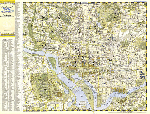
1948 Central Washington, District of Columbia Map
A Pocket Map of Central Washington, District of Columbia is half of a two-map set published in September 1948 with the article American Masters in the National Gallery. Detailed and indexed, this map features all the sites of note, from the White House, the U.S. Capital building, and the Lincoln Memorial, to the Smithsonian, the National Gallery of Art, and the National Zoo. Its companion map, A Pocket Map of Suburban Washington, D.C., Maryland and Virginia appeared in the same issue.
- Product Number: PODHNG_US_DC_48
- Reference Product Number: 2321676M
- ISBN: - None -
- Date of Publication: 6/1/1948
- Unfolded (flat) Size: 24 inches high by 31.75 inches wide
- Map format: Wall
- Map type: Trade Maps - Wall Art
- Geographical region: United States
- Geographical subregion: District of Columbia


