
1948 North Central United States Map
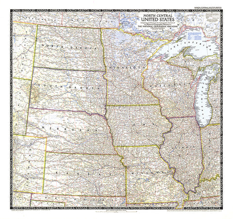
The North Central United States map is the sixth in a series of sectional maps of the United States. Published in June 1948 with two articles including Mapping the Nations Breadbasket, it provides a thorough look at the states of North Dakota, South Dakota, Minnesota, Nebraska, Iowa, Wisconsin, Illinois, Missouri, and Kansas.
- Product Number: PODHNG_US_N_C_48
- Reference Product Number: 2321202M
- ISBN: - None -
- Date of Publication: 6/1/1948
- Unfolded (flat) Size: 27.25 inches high by 29 inches wide
- Map format: Wall
- Map type: Trade Maps - Political
- Geographical region: United States


