
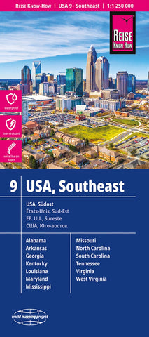
USA, southeast Road Map
South-Eastern USA at 1:1,250,000 in a series of waterproof and tear-resistant, indexed regional maps of USA from Reise Know-How’s highly acclaimed World Mapping Project, combining detailed presentation of the road network with topographic and tourist information. The map is double-sided to provide the best balance between detailed scale and a convenient size sheet, dividing the region east/west. Coverage on the eastern side extends from Baltimore and Washington DC to Orlando and Disney World, and on the reverse extending westwards to beyond Little Rock, AK, and north to St. Louis.
Maps in this series have altitude colouring with spot heights to show each region’s topography, with national parks and other protected areas, as well as American Indian Reservations and restricted entry zones clearly marked. Road network indicates toll roads and scenic routes. Driving distances are shown in miles. Railways and, where appropriate, ferry routes are marked. The maps show both names and
- Product Number: RKH_USA_SE_23
- Reference Product Number: - None -
- ISBN: 9783831772834
- Date of Publication: 6/1/2023
- Folded Size: 10.24 inches high by 4.72 inches wide
- Unfolded (flat) Size: 27.56 inches high by 39.37 inches wide
- Map format: Folded
- Map type: Trade Maps - Road
- Geographical region: United States
- Geographical subregion: Alabama,Georgia,Kentucky,Louisiana,Maryland,Michigan,Missouri,North Carolina,South Carolina,Tennessee,Virginia,West Virginia


