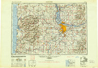
~ Vancouver WA topo map, 1:250000 scale, 1 X 2 Degree, Historical, 1950, updated 1951
Vancouver, Washington, USGS topographic map dated 1950.
Includes geographic coordinates (latitude and longitude). This topographic map is suitable for hiking, camping, and exploring, or framing it as a wall map.
Printed on-demand using high resolution imagery, on heavy weight and acid free paper, or alternatively on a variety of synthetic materials.
Topos available on paper, Waterproof, Poly, or Tyvek. Usually shipping rolled, unless combined with other folded maps in one order.
- Product Number: USGS-5689714
- Free digital map download (high-resolution, GeoPDF): Vancouver, Washington (file size: 24 MB)
- Map Size: please refer to the dimensions of the GeoPDF map above
- Weight (paper map): ca. 55 grams
- Map Type: POD USGS Topographic Map
- Map Series: HTMC
- Map Verison: Historical
- Cell ID: 396049
- Scan ID: 244441
- Imprint Year: 1951
- Aerial Photo Year: 1945
- Datum: NAD27
- Map Projection: Transverse Mercator
- Shaded Relief map: Yes
- Map published by United States Army Corps of Engineers
- Map published by United States Army
- Map Language: English
- Scanner Resolution: 600 dpi
- Map Cell Name: Vancouver
- Grid size: 1 X 2 Degree
- Date on map: 1950
- Map Scale: 1:250000
- Geographical region: Washington, United States
Neighboring Maps:
All neighboring USGS topo maps are available for sale online at a variety of scales.
Spatial coverage:
Topo map Vancouver, Washington, covers the geographical area associated the following places:
- Skamania - Clear Creek - Lakewood - Elwood - Oatfield - Villa Ridge - Norwood - Noble (historical) - Brighton - Barberton - West Saint Helens - Liberal - Linnton - Marylhurst - Necanicum (historical) - Johnson City - Mulloy - Raleigh Hills - Cedar Mill - Eola Crest - Shady Dell - Labish Village - Ireland - Canby - Yamhill - Willamette - Etna - Livingston - Lewisville - Saint Helens - Bethel Heights - Middleton - Scholls - Charter Oak - Reedville - Monitor - Gales Creek - Johnson Crossing - Viola - Clear Lake - Butte Creek (historical) - Hubbard - Kinton - Fernwood - Grand Rapids - Chemawa - Battle Ground West - Union - Multnomah - Albina - Pleasant Home - Six Corners - Troutdale - Mount Pleasant - Battle Ground - Hobsonville - Saltair (historical) - Willamette Heights - Meda - O'Neil Corners - Jennings Lodge - Belle Passi (historical) - Firwood - Bryant - Marlene Village - Yankton - Hollywood - McNulty - Metzger - Cathlapotle (historical) - Hebo - Tideport - Henrici - Pacific City - Amity - Lukarilla - West Portland Park - Oceanside - Hayward - Deer Island - Gladstone - Bayocean (historical) - Dodson - Cedarville - Montavilla - Carnation - Fairdale (historical) - Hamlet - Evergreen - Maywood Park - Pittsburg - Wheatland - North Howell - Marquam - Parker Landing Light - Rockwood - Errol Heights - Carlton - Park Place - Oaklawn
- Map Area ID: AREA4645-124.0833333-122
- Northwest corner Lat/Long code: USGSNW46-124.0833333
- Northeast corner Lat/Long code: USGSNE46-122
- Southwest corner Lat/Long code: USGSSW45-124.0833333
- Southeast corner Lat/Long code: USGSSE45-122
- Northern map edge Latitude: 46
- Southern map edge Latitude: 45
- Western map edge Longitude: -124.0833333
- Eastern map edge Longitude: -122