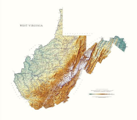
West Virginia, Physical, Laminated Wall Map by Raven Maps
Detailed physical wall map of West Virginia State at a scale of 1:500,000. Laminated.
The cartography shows relief through a stunning, highly detailed shading, with different elevations varying in color, giving an almost 3-dimensional feel to the map. Peak heights are also clearly marked.
The map displays land only within the boundaries of the state - there is no overlap with neighboring states. Principal physical features such as glaciers, mountain ranges, rivers and lakes are shown clearly. Human features, such as main towns, cities, roads and railways, are shown in a very fine, subtle and elegant cartographic style. State capitals are also clearly marked.
This map measures 92 x 102cm (36 x 40). Some of the most rugged land in the country is in the Mountain State. The Allegheny and Blue Ridge Mountain Ranges run from the northeast to the southwest, and the Appalachian Plateau, with its flat-topped highlands and rounded hills, covers the rest of the state of West Virginia.
- Product Number: 2030705M
- Product Code: RP_WV_LA
- ISBN: 9780783426006
- Year of Publication: 1993
- Map type: Wall Map
- Geographical region: West Virginia